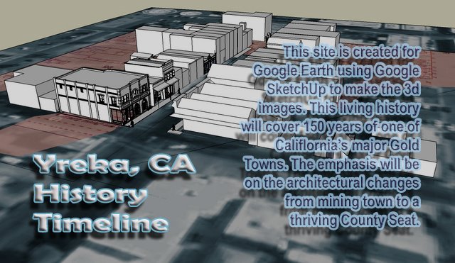

This image of The Historic District of Yreka shows references and beginning modeling. The references are the current day Google Earth image. The pink area is an overlay of a Sandborn Fire Map. The Sandborn maps were created every few years to show the plan view of every building in town for the fire department reference when called to a fire. The one shown is 1901. I worked with the overlay so that it matches the current Google Earth image. Next the basic rectangle shape for each building was created to get the general layout of the town in 1901. The next step is pull the building one at a time and create a detailed 3d model of the building during that period. References to recreate these building have come form several photographic records: The Siskiyou County Museum. Our Books, local individual collections, University of California Davis. Once the detailed 3d image of the building is placed back into Google Earth, It can be called back into SketchUp for further changes and updates then returned to Google Earth. This process has been developed so that this will be "Living Document".


No comments:
Post a Comment